
🔎 This story is still developing. We will update it as we learn more!
Weather Gone Wild! Scientists Say 2026 Could Bring the Strongest El Niño Ever
Quick Summary
Scientists at NOAA — the U.S. agency that studies the oceans and weather — say a powerful weather pattern called El Niño is growing in the Pacific Ocean. It could become the strongest one ever recorded, changing weather around the whole world.
What Happened?
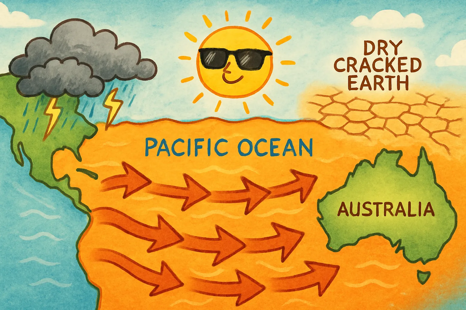
El Niño is a natural event that happens in the Pacific Ocean. Normally, strong winds push warm water westward across the ocean, away from South America. But every few years, those winds weaken. The warm water sloshes back east instead. That extra warmth in the ocean changes weather patterns all over the planet.
This year’s El Niño began forming in June 2026. By mid-September, NOAA confirmed it had crossed an important line — the ocean water near the equator was more than 2 degrees Celsius warmer than usual. That is the level scientists call “very strong.” Some weather experts are calling it a “super El Niño.”
Scientists currently give it a better than 90% chance of reaching “very strong” status this fall and winter. There is also a chance it could go even further — breaking every record in NOAA’s books going all the way back to 1950. It is expected to peak in strength in early 2027.
Why Does It Matter?
El Niño changes weather everywhere — not just near the Pacific Ocean. Different places feel it in different ways.
Parts of California and the southern United States are likely to get much more rain than usual. That can cause flooding. Meanwhile, some parts of Australia and Southeast Asia often get drier during El Niño, raising the risk of wildfires and drought.
An El Niño is like a giant dial that can turn up the rain in some places and turn it down in others — all at the same time.
For now, weather scientists are watching the ocean temperatures very carefully. They want to forecast the changes as clearly as possible so people around the world can prepare.
Big Words
- El Niño — a natural climate pattern where extra-warm water gathers in the eastern Pacific Ocean, changing weather around the world; the name comes from Spanish and means “the little boy” or “the Christ child.”
- NOAA — the National Oceanic and Atmospheric Administration; the U.S. government agency that studies the oceans, atmosphere, and weather.
- Jet stream — a fast-moving ribbon of wind high in the atmosphere that steers storms; El Niño can push it out of its usual path.
- Drought — a long period of much less rainfall than normal, leaving land very dry.
- Forecast — a prediction of what the weather or climate will be like in the future, based on data and science.
Fun Fact
The strongest El Niño ever recorded before this one happened in 1997–1998. That event warmed parts of the Pacific Ocean so much, scientists nicknamed it “The Blob.”
Think About It
If scientists can forecast big weather changes months in advance, how do you think communities could use that information to stay safe and prepare?
Sources
- Al Jazeera — El Nino reaches super status: Where will it bring rain, drought and heat?
- ABC News — Potentially historic El Nino takes shape, with far-reaching US and global impacts expected
- Newsweek — Super El Niño Threat Grows: Map Shows At-Risk States This Winter
- NOAA Ocean Service — El Niño and high tide flooding